|
|
| |
|
Before the turn of the twentieth century, "Esmont," which lies west of Scottsville, referred only to the circa 1820 estate by that name that
was owned Dr. Charles Cocke. He and his family were members of Virginia's wealthy landed aristocracy. Slate quarrying began nearby
in Alberene in 1883. At its peak in the 1920's, Alberene was the nation's larger soapstone producer operating on 6000 acres and employing
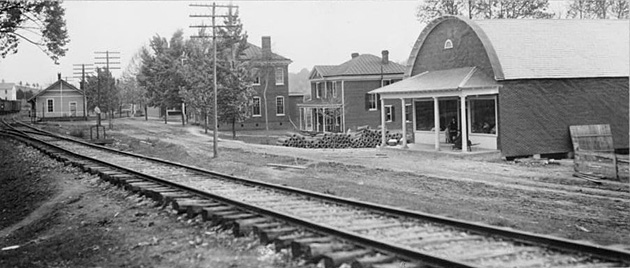
up to 1000 workers. To support this soapstone business and its employees, a railroad and depot, general merchandise and grocery stores,
a school, an inn, a bank, and a post office were established on land parceled from the Esmont property. The growing village also borrowed
the estate's name. "The economy of Esmont in the early twentieth century was centered around slate quarrying, which is evidenced by the slate pier foundations supporting many of the town's historic buildings. Esmont was also a financial center for the region in the early twentieth century and holds one of only three historic banks in the county found outside of Charlottesville. The town also featured at least three stores, a railroad depot, an Episcopal Church and a high school. The site of the slate quarries still remains undeveloped and several, small dry-laid stone structures, along with the quarries themselves and railroad abutments, remain intact. Also similar to Alberene, Esmont features a large Victorian house that was built to house the manager of the quarry. The fortunes of Esmont paralleled those of Alberene, although the fact that the town had developed a small individually-owned commercial core allowed it to survive longer than its northern company-owned cousin. Today, the center of Esmont is the Esmont National Bank, which now serves as a post office. Currently a quiet residential village, the town as a whole has had trouble finding an economic rhythm for several decades. However, Esmont has retained a vibrant African-American population that was recently the focus of an oral history project sponsored by the Carter G. Woodson Institute. Through this project, and a collection of letters from the African-American educator Benjamin Yancey, Esmont has become a significant source of knowledge for those studying rural early-twentieth century, African-American communities." The rural community is marked by a few two-lane paved roads, which frame wide stretches of hills and woods. A semi-hidden but extensive
network of small lanes trail off from the main roads, opening up to hidden-away houses and other properties. There are both large estates
and comparatively modest clusters of homes. Small commercial buildings and churches, several of which give name to local roads, are
scattered throughout, with the greatest concentrations in the village centers of Esmont and Porters. References: Scottsville Museum wishes to thank Maxwell Johnson, our 2018 Institute For Public History (IPH) Intern from UVA, for his dedicated and thorough research on Esmont as well as for his many photographs of the Esmont area. The Museum is also most grateful to the Mellon Foundation, who funded Maxwell's internship on this project, and to Dr. Lisa Goff, Director of IPH, for all of her support and encouragement to the Museum and Maxwell on this project. Additionally, thanks to Fannie Louden for the numerous road trips she took with Maxwell, Connie Geary, and Evelyn Edson to map out the many interesting Esmont sites for this project. Most well done, Maxwell, Mellon Foundation, Dr. Goff, IPH, and the Scottsville Museum team! Please click on each image below for a larger view and more information. |
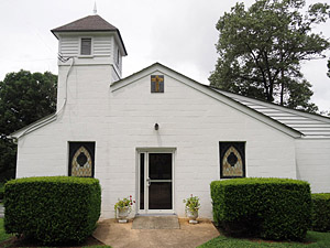
Esmont Churches | ||
|
||
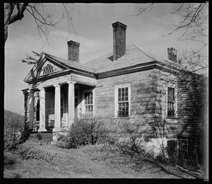
Esmont Homes | ||
|
||
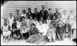
Esmont Schools | ||
|
||
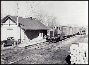
Esmont Businesses | ||
|
||
|
Museum
Archive
Business
Cemeteries
Church
Events
Floods
For Kids
Homes
Portraits
Postcards
School
Transportation
Civil War WWII Esmont Search Policy
|
||||
| Scottsville Museum · 290 Main Street · Scottsville, Virginia 24590 · 434-286-2247 | ||||
|
www.avenue.org/smuseum · info@scottsvillemuseum.com Copyright © 2018 by Scottsville Museum |
||||